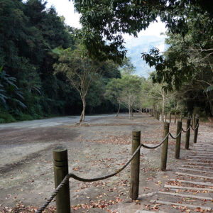
The “COAST TO PEAK” race course is built upon the geographical context of the Shanhai-Zhen National Greenway, one of Taiwan’s seven major national greenways. It is a vertical adventure track that cuts across the island, stretching from the coastal plains directly to the heart of the Central Mountain Range.
The odyssey begins at the National Museum of Taiwan History, symbolizing a departure from the very roots of Taiwanese history. As the journey unfolds, participants traverse the century-old irrigation heritage of the Jianan Canal, venture into the ancestral mountain forests of the Tsou Tribe, and ascend along a path where civilization and nature intertwine.
The course transitions from fertile plains to rolling tea gardens, eventually deep-diving into high-altitude forest zones. As the elevation climbs and the air thins, participants reach the Yushan National Park Boundary Stone, completing the ultimate “Shore to Summit” challenge. The peak of Yushan (Mount Jade) itself is reserved for each finisher—after the pressure of the race has faded—to complete that final segment at a pure, un-timed pace, engaging in a silent dialogue with themselves, the land, and the heavens.
This is more than an ultimate test of physical endurance; it is an Adventure Odyssey that connects the sea, civilization, and the Sacred Mountain.

Starting from sea level, stepping into a four-hundred-year corridor of time.
Elevation: Min. 0 meters, Max. 21 meters | Total Distance: 31.1 km
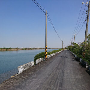
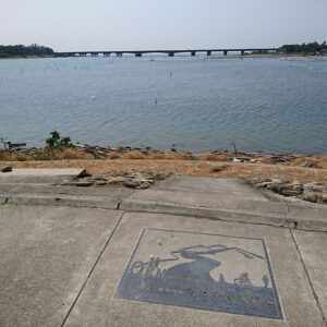
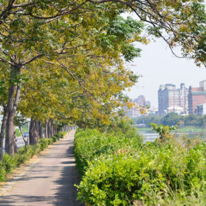
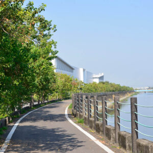
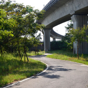
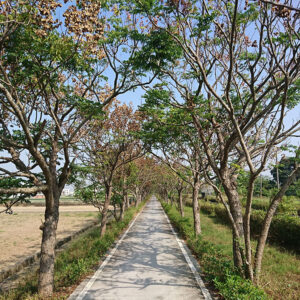
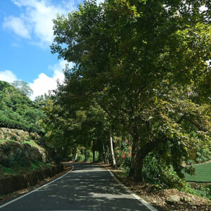
The prelude to this Ancestral Odyssey begins on a 31.3-kilometer flat stretch, where runners tread upon the remains of the Taijiang Inner Sea—a vast expanse of ocean back in the 17th century. Participants will weave through a wetland landscape of mangroves, oyster racks, and salt pans, witnessing the profound metamorphosis of the land shaped by centuries of floods and the shifting course of the Zengwen River.
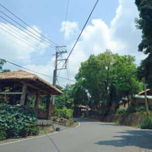
Starting from the National Museum of Taiwan History, these 20-plus kilometers are more than just a physical warm-up; they are a chronological traverse. Runners will witness the land’s transformation from a strategic maritime hub during the Dutch Age of Discovery and the historic landing site of Koxinga’s forces, into the modern high-tech corridors of today. This segment sets a sacred stage for this Adventurous Pilgrimage, marking the beginning of an epic ascent.
Resilience of Will: A 50km Odyssey Along the Earth’s Arteries.
Elevation: 3–527 meters | Total Distance: 49.8 km
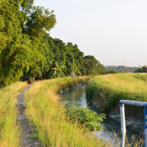
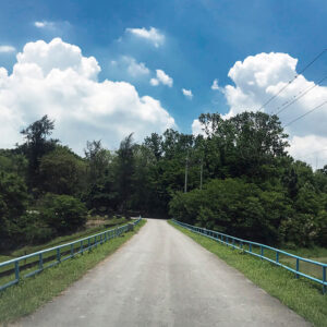
As the course enters the second stage, hailed as the “Essence of Hydraulic Engineering,” the challenge shifts into a profound test of mental resilience. This 49.8-kilometer segment leads participants northward along the Jianan Canal South Main Line, traversing the districts of Guantian and Liujia.
The most captivating technical marvels of this route are the “Three Great Aqueduct Bridges” spanning the Zengwen, Duzitou, and Guantian Rivers. These designated city monuments are “bridges for water,” ingeniously designed a century ago to allow the canal to soar above the rivers—a testament to the precision and visionary engineering of the past.
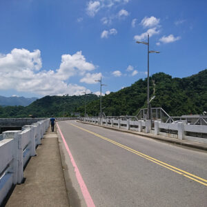
As the elevation gradually climbs to 527 meters, runners will arrive at the heart of the Jianan Canal: the Wushantou Reservoir. Amidst the century-old shadows of the great earth-fill dam and the Hatta Yoichi Memorial Park, participants will complete this long-distance test of endurance, fully immersed in the intersection of cultural heritage and the ever-changing landscape.
A Cultural Baptism: Deep into the Soulful Heartland of the Tsou.
Elevation: 226–2,303 meters | Total Distance: 70.2 km
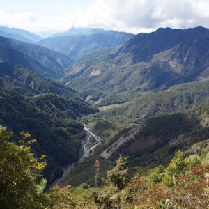
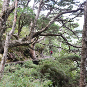
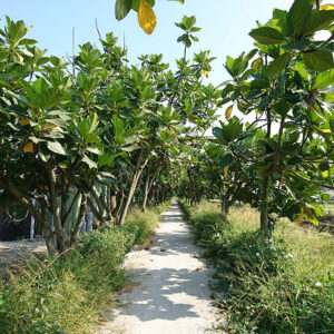
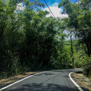
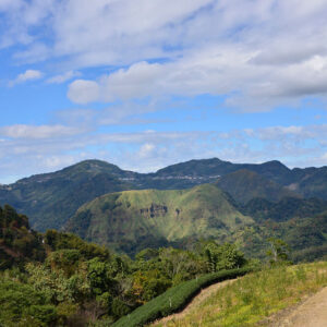
The race enters its most culturally resonant and naturally breathtaking chapter: the third stage. Spanning 70.2 kilometers from the Dapu Lover’s Park Pier, the course climbs steeply to an elevation of 2,303 meters, venturing deep into the unpredictable high-altitude territories of the Tsou people.
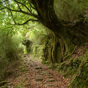
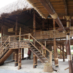
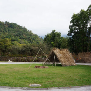
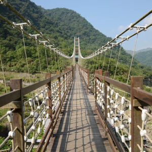
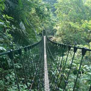
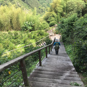
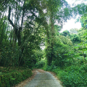
Runners will traverse the ancestral lands of Chashan, Dabang, and Tefuye, winding through orchards, tea plantations, and bamboo forests. Along the way, participants will pass iconic landmarks such as the Kuba (the traditional male meeting house) and the Neiyechi Suspension Bridge that spans the deep valleys.
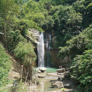
This is more than a mere ascent through alpine landscapes; it is a profound cultural dialogue with indigenous beliefs and social customs. Accompanied by the thunderous roar of Qingyun Waterfall and the vibrant murals of the Tsou villages, runners will feel the powerful energy of a civilization living in harmonious coexistence with the rugged wilderness as the elevation rises.
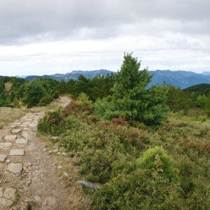
Defy the Extreme. Honor the Sacred Summit.
Elevation: 2,273–3,952 meters | Total Distance: 26.0 km
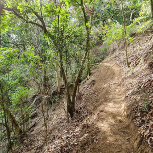
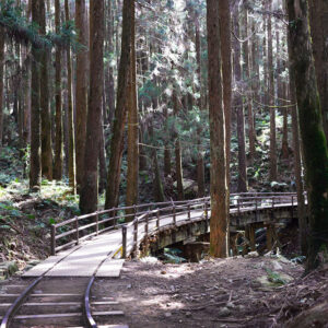
The grand finale unfolds on the “Path to the Sacred Mountain.” As the highest and most spiritually symbolic segment of the race, participants must conquer a 12.3-kilometer high-altitude ascent through thinning air. The landscape undergoes a dramatic metamorphosis, shifting from the resilient Taiwan Red Pine forests to the subalpine coniferous forests of the cold-temperate zone, finally leading to the glorious finish line: the Yushan National Park Boundary Stone.
For generations, Yushan (Mount Jade) has stood as a sacred symbol guarded by the Tsou and Bunun peoples. The Boundary Stone marks more than just a finish line; it signifies that the runner has successfully traced the source from sea level to the very threshold of the Sacred Mountain.
As the official race concludes at the Boundary Stone, the remaining 13.7 kilometers to the summit are reserved for the finishers as a “GoNext!” personal pilgrimage. Free from the pressures of competition, runners are invited to complete this final stretch at their own pace—a pure, un-timed dialogue between themselves and the pinnacle of Taiwan.